
In an era where efficiency, sustainability, and precision drive mining operations, satellite-based mineral prediction is revolutionizing the exploration landscape. Traditional mineral exploration involved extensive field surveys, drilling programs, and trial-and-error approaches, consuming vast time and resources. Now, with advanced satellite imaging and AI-powered analysis, mining companies can identify optimal mineral zones with unprecedented accuracy, speed, and environmental responsibility.
The Limitations of Traditional Exploration
Conventional exploration methods rely heavily on:
- Ground surveys and manual mapping
- Multiple drilling campaigns to locate deposits
- High operational costs and fuel consumption
- Disruption to natural ecosystems and communities
These processes often led to partial data accuracy and environmental degradation, especially in ecologically sensitive areas.
How Satellite-Based Mineral Prediction Works
Bluore’s satellite-based mineral prediction system uses high-resolution multispectral and hyperspectral satellite imagery combined with AI models to detect surface mineral signatures and geological structures. Here’s how it transforms exploration:
- Data Acquisition: Advanced satellites capture images of targeted regions across multiple spectral bands, revealing subtle mineralogical variations invisible to the human eye.
- AI Analysis: Machine learning algorithms process the spectral data to identify and classify potential mineral zones with high confidence levels.
- Validation: Minimal field verification is conducted to confirm findings before targeted drilling and extraction planning.
This approach drastically reduces exploration time from months to weeks while minimizing environmental disturbance.
Key Benefits of Satellite-Based Mineral Prediction
- Pinpoint Accuracy: Identifies mineral presence, concentration, and extent with high precision, reducing unproductive drilling.
- Cost-Efficiency: Cuts down on extensive field survey expenses and operational manpower requirements.
- Environmental Responsibility: Limits ecological disruption by avoiding widespread land clearing and sampling.
- Strategic Planning: Enables informed decision-making for infrastructure, machinery deployment, and environmental management plans.
- Rapid Assessments: Accelerates project timelines, giving mining companies a competitive edge in mineral acquisition and development.
Real-World Applications
Bluore has successfully implemented this technology in India, Ghana, and Somalia, enabling:
- Identification of previously undiscovered mineral-rich zones
- Optimisation of extraction strategies based on detailed mineral mapping
- Improved compliance with environmental and land-use regulations
In a recent project in East Africa, our satellite-based mineral prediction reduced exploration costs by 40% and accelerated project commencement by three months.
Integrating Prediction with Extraction
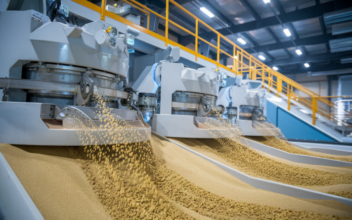
Our expertise goes beyond prediction. By integrating satellite data with our water-only gold recovery and portable processing units, Bluore provides a full-cycle solution from exploration to sustainable extraction, ensuring maximum yield with minimal environmental impact.
The Future Ahead
As global demand for minerals rises to support renewable energy and infrastructure growth, mining companies need solutions that are fast, accurate, and environmentally conscious. Satellite-based mineral prediction stands at the forefront of this future, empowering companies to unlock mineral wealth efficiently and responsibly.
Ready to revolutionise your exploration strategies?
[ Talk to Bluore’s mineral prediction experts today. ]

